
Business Details
23 Years
experience
Professional Aerial Photography Services in Houston
AirBorn Imaging opened for business in January 2003 by Tom & Michelle Replogle. Since then we have had the pleasure of shooting custom aerial photography and construction progress aerial photos and videos for hundreds of businesses, individuals, and governmental agencies across the country. We started out shooting aerial photos from helicopters and airplanes using road atlases to find our projects from the air. Now we use state-of-the-art hardware, software, and GPS to pinpoint your project accurately and reduce flight time which saves our clients money. When drones with cameras first appeared on the market, we quickly adopted them to provide our clients with an affordable alternative to helicopters. Our goal from the very beginning was to give our clients the best customer service possible. We strive to provide our clients with the sharpest aerial photos and videos, the quickest turnaround times, all at reasonable rates. Experience is important when you are selecting an aerial photography company. Tom has been in the aerial photography field since 1994. First working as an image analyst and GIS technician for Park Aerial Surveys out of Louisville, KY, and later for the James W. Sewall Company out of Bangor, ME, Tom learned the skills behind the production of quality aerial photos. On the aviation side of things, Tom has been around airplanes since he was a kid. Tom holds the highest certificate possible in aviation, the Airline Transport Pilot certificate, and has thousands of hours of flight time. Safety is paramount to us so you can be assured that your aerial photo mission will be flown to the highest standards. Behind the lens, Tom has been shooting photos for well over 20 years. His passions of landscape photography and flying seemed like a natural fit together and thus was born the idea for AirBorn Imaging. Give us a call today and let us get started on your next aerial photography project. We guarantee satisfaction.
Services
Aerial Photography
Drone Aerial Photography
Construction Progress Imaging
Real Estate Photography
Aerial Mapping
Custom Aerial Projects
Details
- Year established: 2003
Highlights and features
- We have over 20 years of experience in aerial photography and aviation.
- Our FAA-certified pilots maintain the highest safety and operational standards.
- We guarantee quick turnaround times with competitive pricing.
- We combine traditional aircraft and drone technology for optimal results.
- We provide nationwide coverage with local Houston expertise.
Associations and certifications
- FAA-certified Part 107 Remote Pilot Certificate
What people say
Consistently excellent
Outstanding quality
Quick turnaround
Impeccable timing
Responsive service
Services
Aerial Photography
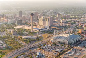
AirBorn Imaging provides high-quality aerial photography using both traditional aircraft and drones. Our services capture detailed visuals for construction documentation, real estate marketing, and custom projects. With FAA-certified pilots and advanced equipment, we deliver precise, high-resolution imagery tailored to client needs across Houston and nationwide.
Drone Aerial Photography
Our FAA-certified drone operations offer cost-effective aerial photography solutions for construction monitoring, real estate, and mapping. Equipped with Part 107-certified pilots, we provide flexible scheduling and rapid deployment for projects requiring detailed aerial data within regulatory compliance and safety standards.
Construction Progress Imaging
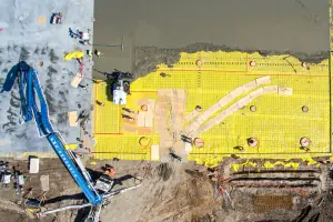
Specializing in construction documentation, we offer scheduled aerial photography to track project milestones. Our services help project managers identify issues early, maintain timelines, and provide stakeholders with visual progress reports using both drone and manned aircraft platforms for comprehensive coverage.
Real Estate Photography
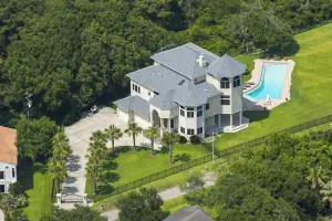
We create compelling aerial visuals for real estate listings using advanced drone and aircraft technology. Our services highlight property features, neighborhood context, and unique selling points through high-resolution imagery that enhances marketing materials and attracts potential buyers.
Aerial Mapping
Our drone-based mapping solutions generate precise orthophotos and 3D models for land development, infrastructure projects, and environmental assessments. Using specialized software and FAA-certified equipment, we deliver accurate geospatial data that supports planning, analysis, and decision-making processes.
Questions
What areas do you serve for aerial photography?
We primarily serve Houston, Dallas, Austin, and San Antonio, Texas, but provide services nationwide through our network of certified drone operators.
Are your drone operators FAA-certified?
Yes, all our drone pilots hold FAA-certified Part 107 Remote Pilot Certificates and maintain full insurance coverage for all operations.
How quickly can you complete an aerial photography project?
We typically deliver images within 24-48 hours after capture, with emergency same-day service available for urgent requests in the Houston area.
What types of projects do you handle?
We specialize in construction progress documentation, real estate photography, aerial mapping, and custom projects including event coverage and industrial inspections.
Can you match historical aerial shots?
Yes, we can recreate historical aerial photographs with precise positioning to document changes over time, as demonstrated in our Galleria area replication project.
What equipment do you use?
We use professional full-frame digital cameras, medium format film equipment, and advanced drones with 4K video capabilities for both traditional and drone-based operations.
Videos
Reviews (5)
Diane Kirby
Jun 09, 2018
Report
Doing business with Airborn was very easy with excellent results. Tom was receptive and accommodating to our needs. Thank you, Tom!
Ilissa Knisley
Dec 14, 2017
Report
We called Tom to take some aerial photos of a 17,000 sf estate in The Woodlands our firm handled in 2016. Not only was he quick to respond, but he had my job scheduled and completed in excellent time and returned images to us that were crisp, clear, and had pleasing composition--which is not the case with all aerial photographers. From start to finish my job was done within days, and I think that even included a weather delay! The next time I have need of helicopter aerial shots in the area, Tom will be the first person I call. He does truly excellent work.
Debbie P.
Thank you so much for such beautiful photos. It was a pleasure working with you. We will definitely use your business again!
John S.
AirBorn Imaging has satisfied all our needs! From low resolution imaging for our website to high resolution imaging for global presentations, the quality and service Tom offers is superb.
Diane K.
Doing business with Airborn was very easy with excellent results. Tom was receptive and accommodating to our needs. Thank you, Tom!